Link to the route.
Around Burlats and Lacrouzette are the Sidobre. The Sidobre themselves are granite rocks that, due to some unusual weathering of the last few thousand years or so, now look like giant pebbles. The really weird thing is that several have ended up stacked on each other:


Each of those is the size of a car. In the last case, a very large van. And no, I didn't push it to see.
This stretch of the ride was the most tricky, as it involved zig-zagging all over the area down country lanes and in one place an im-promptu off road section down a muddy footpath and over several half-buried rocks. Note to self: if Google Maps thinks a path is good, but Garmin says otherwise, be prepared for things to get bumpy. And muddy.
After I finished looking at rocks, I had a nice meandering route following the Agout river as it winds toward Lac de la Raviege. However the first part of road was marked as closed...on the off-chanceI would be able to get through on the bike, I took the turn. With the road blocked, there had been no traffic to clear the leaves, so what I had was a beautiful ride (albeit slightly slippery in a couple of wet areas) that gave me some half-decent video.
A little blurred, as I need to sort out the vibration on the camera mount...but that is a job for another day.
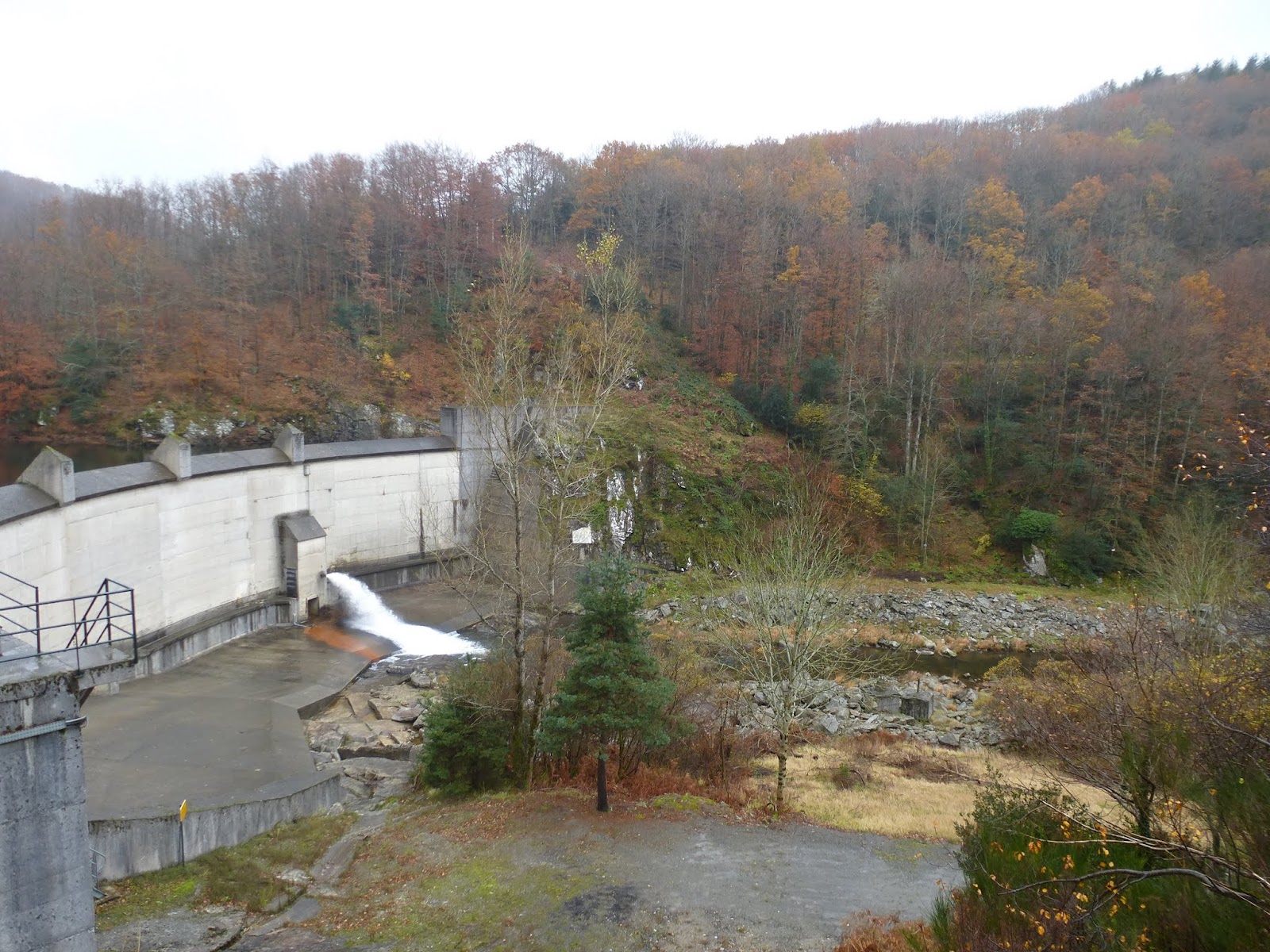
Passing the Lac de la Raviege, with it's HEP dam:
Unusually for one of my rides, I hadn't yet passed somewhere for fuel, and as I approached La Salvetat-sur-Agou found that both fuel stops were shut (and I don't just mean closed on the day...they both looked closed for the winter). With my route due to head north and into an even more remote area my Garmin was showing no fuel within my remaining range...but there was a spot 10 miles to the south that I could detour to. Easy, huh?
Yeah, right.
The shortest route to Saint-Pons-de-Thomières, the Location of the Hallowed Fuel, was directly over a col. Two cols, to be precise. Neither particularly high (about 900m) but both currently in the clouds.
Take the road in my video. Make it more twisty. And narrow. Add heavy rain. And 20m visibility.
There should have been a steep drop to one side (these roads usually do) but I'm damned if I saw it. Most of the time I could see the lane markings.
Fortunately, Saint-Pons-de-Thomières had a 24/24 fuel as promised, so a quick coffee later I was ready to rejoin my route and continue my journey.
On the other side of that damn mountain.
Oops.
At least this time I knew what to expect.
Back in Saint-Pons-de-Thomières I found the road on towards the next planned stop at the Lac do Laouzas. This was another HEP dam at one end of a large valley, but it was raining too hard to get the camera out.
After a soggy look at the map, I decided not to carry on the planned route along the Michelin-suggested scenic routes, but to cut north to Moulin Mage (just because of the name) then head homeward from there.
All in all, not a bad day out. 240 miles in about 8 hours or so.
Time to plan the next trip...bring on the snow!
No comments:
Post a Comment